
After spending a week in Yellowstone National Park, I can now say it’s one of the most beautiful national parks I’ve ever been to! With some of the most unique natural formations I’ve seen, so much of this park feels magical and otherworldly. And here I hope to include the best photo spots in Yellowstone National Park so that you don’t miss a thing!
To get a sense of our trip, be sure to check out the video we made of our visit!
If you don’t see a video player below, you may need to disable your ad blocker.
There are five entrances to the park, so I’ve organized these Yellowstone photo spots to go from the West Entrance to Old Faithful, then up to the North Entrance, then over to the Canyon Village area toward the East Entrance, up to the Northeast Entrance, then down to the South entrance.
You’ll find a map of these Yellowstone photo spots at the very end of this post. And as you plan your Yellowstone trip, don’t forget to read this post on 23 things to know before visiting Yellowstone!
So, let’s get to it! Here are the best photo spots in Yellowstone National Park.
1. Madison River

Effort required: minimal; pull-off on the side of the road
After you head into the West Entrance to Yellowstone, you’ll catch glimpses of this gorgeous river. There are several pull-offs for fishing access and picnic spots. I found the lighting particularly dreamy in the early morning- we typically headed into the park around 7am. The Madison River is a tributary of the Missouri River – it turns into the Missouri River when it meets the Gallatin and Jefferson rivers. It runs through both Wyoming and Montana.
2. Firehole Falls

Effort required: minimal; pull-off on the side of the road.
Firehole Falls is located on the Firehole River, near the confluence of the Gibbon River, in Yellowstone. It’s right by the western entrance to the park, and though you technically can’t hike down to it (it’s such a steep and slippery walk, but we actually saw people do it!), the views are incredible from up top! Interesting fact: the area around Firehole Falls was barren of fish for a while, but brown trout and rainbow trout were introduced in the late 19th and early 20th centuries.
3. Fountain Paint Pots Trail

Effort required: minimal; boardwalk walking trail
The Fountain Paint Pots trail journeys along a particularly active thermal area of Yellowstone’s supervolcano. Its unique geography means that you can enjoy some breathtaking multicolored scenery – hence the name of the trail! (Side note- Harrison doesn’t like this photo because it “makes Yellowstone look cold.” But if you visit at sunrise in the early summer, it can get so cold! It was probably in the 30s here- though it got up to the 80s later that day!)
4. Great Fountain Geyser

Effort required: minimal; pull-off on the side of the road with a short walk to the boardwalk
The next two spots are off a one-way road, Firehole Lake Drive, that loops off of the main road. It is a three-mile loop, and the first major Yellowstone photo spot you’ll find is Great Fountain Geyser. It is a geyser (a type of hot spring that shoots into the air) in the Firehole Lake area of Yellowstone National Park. Great Fountain Geyser erupts up to 100 feet high in a series of bursts. This happens about every 10-14 hours. Unfortunately, that big time frame means it’s hard to catch this geyser in action, but I think it’s beautiful even when it’s not erupting!
5. Firehole Lake

Effort required: minimal; pull-off on the side of the road
As you drive to the lake on Firehole Lake Drive, you’ll pass some other cool spots besides the Great Fountain Geyser, including features like Firehole Spring, Surprise Pool, and White Dome Geyser, so be sure to keep your eyes peeled. But the next Yellowstone photo spot worth mentioning is Firehole Lake. As the name suggests, Firehole Lake is a thermal lake in the national park. It has an unusual color due to thermophiles, which are a type of heat-loving water bacteria living underneath the water. I just love the way the steam looks in photos, which is why I had to include it on this list of best photo spots in Yellowstone!
6. Excelsior Geyser Crater

Effort required: boardwalk trail leads you from the parking lot to the Grand Prismatic. Parking is difficult from 10am-5pm.
As you continue down Highway 191, you’ll reach the Midway Geyser Basin, which includes the next few spots. After you park and start the boardwalk hike to Grand Prismatic Spring, the first major thermal feature you’ll see is Excelsior Geyser Crater. It is a dormant geyser in Yellowstone National Park. It frequently erupted until about 1900, and eruptions were about 100 feet high. Nowadays, it is a crater and pool above the Firehole River. The steam here looks like blue cotton candy to me!
7. Grand Prismatic Spring

Effort required: boardwalk trail leads you from the parking lot to the Grand Prismatic. Parking is difficult from 10am-5pm.
Continue along the boardwalk to see Grand Prismatic Spring: the largest hot spring in the country and the third-largest in the world! It is larger than a football field, with a whopping diameter of 370 feet. It is also deeper than a 10 story building. Grand Prismatic is famous for its bright, vibrant colors, including orange, yellow, and blue. There are also lots of microbes in the spring that have helped NASA and other leading scientists with their research!
8. Grand Prismatic Spring Overlook

Effort required: moderate; requires hiking up an incline
For another vantage point of the Grand Prismatic, head to this spot! The Grand Prismatic Spring Overlook is a 1.2-mile there-and-back hiking trail that takes you from Fairy Falls Trailhead and offers an incredible view of the hot spring. You’ll climb 105 feet over the .6 mile one-way trek, and the views will amaze you! This hike is a must if you’re able!
9. Fairy Falls

Effort required: moderate; it’s a flat but long 4.5-mile trail.
Fairy Falls is a 220-foot high waterfall that descends into Fairy Creek. It is one of Yellowstone’s tallest waterfalls and is the ideal spot for a picnic and to enjoy nature. The hike from the parking lot is 4.5 miles long total (there and back), but you can stop at the Grand Prismatic Spring Overlook on the way and kill two birds with one stone! It’s a flat path but offers little shade, so bring plenty of water and wear sunscreen!
10. Morning Glory Pool

Effort required: moderate; it’s a relatively flat 2-mile trail.
This is by far my favorite hot spring in Yellowstone and is without a doubt one of the best photo spots in Yellowstone. Located in the Upper Geyser Basin, Morning Glory Pool is another incredible hot spring. It was named after the morning glory flower, as the park superintendent’s wife in 1883 saw a resemblance between it and the plant. It is one of the best Yellowstone photo spots (to me, at least!) for two reasons. First, look at how incredible its colors are! Second, since it requires a two-mile hike, it doesn’t get quite as crowded as the other hot springs around it.
11. Old Faithful

Effort required: minimal; once you park, you just walk to the boardwalk viewing area.
Being perhaps the most famous and well-known feature in the park, Old Faithful definitely deserves a spot on this list of Yellowstone photo spots! Old Faithful is another geothermal geyser. It erupts approximately every 1.5 hours, give or take ten minutes. Over a million of its eruptions have been recorded- truly is a faithful ‘ol geyser! As it is so active, it’s essential to stay on the boardwalk so that you see Old Faithful from the specified viewing area, which is a safe place to stand.
12. Old Faithful Viewing Area

Effort required: moderate; hiking up switchbacks.
Want a different view of Old Faithful? A .5 mile hike up a bunch of switchbacks will take you to a view over the whole Upper Geyser Basin. We opted to see Old Faithful from the boardwalk, and since it takes 1.5 hours for her to erupt again, we decided to nix this spot to save some time. However, I wanted to add it to this list of Yellowstone photo spots so that you know about it!
13. Artists Paintpots

Effort required: minimal; a walking path brings you to a boardwalk trail.
The Artists Paintpots is a selection of geysers, mud pots, and springs. You can walk to the Artists Paintpots on a boardwalk trail, and there are several viewing areas where you can gaze over the panoramic view.
14. Norris Geyser Basin

Effort required: minimal; a boardwalk trail leads you all around Norris Geyser Basin. It can be a long walk if you decide to do the full loops around the Basin. Parking can be difficult from 10am-5pm.
Pictured above is the Porcelain Basin portion of the Norris Geyser Basin. Norris Geyser Basin has a few records – it is the oldest, hottest, and most active thermal area in Yellowstone. Once, a temperature of 459F was recorded only 1000 feet below the surface. It also dates back at least 115,000 years!
15. Roaring Mountain

Effort required: minimal; pull-off on the side of the road
Roaring Mountain is a popular mountain that you can easily see off of Grand Loop Road in Yellowstone. This is one of my favorite pull-offs in Yellowstone, particularly when the fumaroles (steam vents) are active! It seems as if the mountain is breathing! Roaring Mountain was named after the roaring noise that is created from fumaroles on the slopes and is around 7400 feet high.
16. Yellowstone’s Boulders

Difficulty level: moderate; includes climbing boulders.
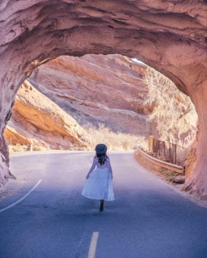
Here’s a spot you can’t miss as you’re driving on Grand Loop Road near Mammoth Hot Springs. And what I mean by “can’t miss” is that this spot is so unlike anywhere else in the park, with giant boulders surrounding both sides of the road. There are a couple of pull offs here; we parked at one and scrambled up a few rocks to find this vantage point. It was so fun climbing on these massive boulders, but I hope it goes without saying that you should be careful! You can search this spot as “Silver Gate” in Google Maps, which is the name of the mountain pass here. (Also, note that we took the photo at the very beginning of this post just south of Silver Gate at Swan Lake.)
17. Mammoth Hot Springs

Effort required: minimal; a boardwalk trail (with some stairs) leads you all around the terraces at Mammoth Hot Springs.
Mammoth Hot Springs is a must-visit in Yellowstone. Carved out of limestone, each pool holds crystal-clear water and it is known as an ‘inside-out cave’. Pictured above is the Palette Springs portion of Mammoth Hot Springs.
18. Minerva Terrace

Effort required: minimal; a boardwalk trail (with some stairs) leads you all around the terraces at Mammoth Hot Springs.
The Minerva Terrace is another part of the Mammoth Hot Springs. This rocky area has a spectrum of colors and goes through various cycles of activity.
19. Roosevelt Arch

Effort required: minimal; you can park and walk to the arch.
The Roosevelt Arch is one of the few human-made attractions in Yellowstone National Park. Located at the north entrance, the arch was proposed by Hiram Martin Chittenden, who discerned that there needed to be a dramatic entrance to the park. An inscription on the arch reads ‘for the benefit and enjoyment of the people.’ Seeing as Yellowstone was the first official national park, it’s quite fitting that it has this stately entrance arch.
20. Hayden Valley

Effort required: minimal; pull-off on the side of the road
The sub-alpine Hayden Valley used to be a part of Yellowstone Lake. It has since dried up, leaving behind a more barren valley. You can drive through the valley to Yellowstone Lake – it is one of the most spectacular drives in the park. We especially loved seeing it at golden hour in the early morning! It’s also a great spot to see wildlife. (Tip: early morning and evening are some of the best times to see wildlife, since that is when most come out to graze!)
21. Brink of the Lower Falls

Effort required: moderate; the trail is short but steep, with many switchbacks.
The next few spots on this list are along North Rim Drive, which essentially runs parallel to the northern part of the canyon. You can hike between these next spots, though I prefer to drive it along the one-way North Rim Drive, simply because it’s easier and some of these spots require a bit of hiking anyway. The first major Yellowstone photo spot here is Brink of the Lower Falls. It’s a short trail (just over one mile) that takes in the Grand Canyon of Yellowstone from the top of the stunning Lower Falls. Though the trail isn’t very long, it is a switchback trail that has several steep parts. I did the hike in sandals VERY SLOWLY, and if I redid it, I’d wear my hiking boots! It’s also a doozy coming back up the steep incline!
22. Lookout Point

Effort required: minimal; it’s a short walk from the parking area to the viewing area.
The next spot you’ll reach is one of the best photo spots in Yellowstone if you want a photo with the Lower Falls. Lookout Point is a vantage point on the North Rim of the Grand Canyon with excellent vistas over the Lower Falls. If you want to get closer to the falls, you can check out the next spot on this list, which is a trail that departs from this same area.
23. Lower Lookout Point

Effort required: moderate; the trail is short but steep, with many switchbacks. There is a series of stairs at the end.
You can access Lower Lookout Point from Lookout Point. After a switchback hike that ends in a staircase, you’ll reach the observation deck, which is a great place to see the crashing waters of the falls. I shot the photo above with my 24mm-120mm lens at full zoom, which creates lens compression and makes the falls look closer than they are, so keep that in mind!
24. Inspiration Point

Effort required: minimal; it’s a short walk from the parking area to the viewing area.
Here’s the last major pull off along North Rim Drive. Inspiration Point is a lookout where you can view the Grand Canyon of the Yellowstone River. You’ll be able to take in part of the falls, as well as the epic craggy cliffs of the canyon. The canyon is constantly shaped by tremors and earthquakes.
25. Upper Falls View

Effort required: minimal; it’s a short walk from the parking area to the viewpoint.
Next, you can drive down South Rim Drive to see this photo spot and the next one, too. This is one of the best photo spots in Yellowstone if you want to see the Upper Falls! I absolutely love the view of the here, especially considering there are not many places where you can see the Upper Falls. It just requires a very short walk to the overlook, and is on the way to Artist Point, so you should definitely add this to your Yellowstone itinerary!
26. Artist Point

Effort required: minimal; it’s an easy 5-minute walk from the parking lot to the viewing area.
Go a bit further down South Rim Drive and you’ll find the coolest view of the Lower Falls and the river below. Artist Point is a popular overlook on the Grand Canyon of Yellowstone. From here, you will be able to take in the Lower Falls, which is the most recognizable part of the Grand Canyon.
27. Point Sublime

Effort required: moderate; it’s a flat path, but is next to a steep cliff.
*We didn’t do this one due to weather.* From Artist Point, you can do a 2.7-mile hike to Point Sublime. Though we didn’t get to do this one as a storm started brewing, from research, the trail is relatively flat. You’ll have great views along the way, and the last great lookout happens around 3/4 of the way to the end of the trail. Be careful as you’re walking- most of the trail is close to the edge of the cliff, so it’s definitely not the most kid friendly trail in Yellowstone! You won’t see waterfall views here; instead, you’re treated to deeper views of the canyon and the mountains around it.
28. Dunraven Pass

Effort required: hard; 6-mile hike to Mount Washburn.
*We didn’t do this one due to road closures.* Dunraven Pass is a craggy and scenic mountain pass in Yellowstone National Park. It sits at over 8000 feet and is named after Dunraven Peak which is located close by. A 6 mile there-and-back trail brings you to Mount Washburn, from which you’ll have spectacular views of the valleys and mountains around it.
29. Tower Falls

Effort required: minimal; pull-off on the side of the road
*We didn’t do this one due to road closures.* Usually, this is one of the most accessible waterfalls in Yellowstone. It was made famous in 1871 when it was photographed by William Henry Jackson. It falls for a whopping 132 feet!
30. Lamar Valley

Effort required: minimal; pull-off on the side of the road
Animal lovers, this one is for you! Lamar Valley is often called ‘America’s Serengeti’ due to the amount of wildlife you can enjoy. It is in the northeast ernpart of Yellowstone and is home to the Lamar River, a Yellowstone River tributary. We saw hundreds of bison here, a ton of elk, several pronghorns, and a black bear and its cub.
31. Trout Lake

Effort required: moderate; requires a steep hike through Douglas Firs. You can hike to the lake or continue and do the full loop around it.
Trout Lake has also been called Fish Lake and Soda Butte Lake. Popular with hikers and anglers, it has a walking trail around its circumference. The surface area is 12 acres.
32. Yellowstone Lake

Effort required: minimal; pull-off on the side of the road
One of the most popular attractions in Yellowstone, this lake is the largest body of water in the whole National Park. It is 7732 feet above sea level and has a surface area of 136 square miles! It also has six islands within the lake. Yellowstone Lake freezes over in the winter – sometimes staying frozen until the late spring – and the only non-ice parts are the hot springs.
33. West Thumb Basin

Effort required: minimal; a boardwalk trail takes you around the basin.
34. Black Pool

Effort required: minimal; a boardwalk trail takes you around the basin.
Black Pool is a popular hot spring in the National Park. I know what you’re thinking… that doesn’t look very black! Until 1991, it was home to a range of cyanobacteria, but due to shifting thermal energy, it is now too warm to host these. It was called Black Pool because the color of the cyanobacteria with the blue water caused it to look black. Although this is no longer the case, it has kept the name.
35. Lewis Falls

Effort required: minimal; pull-off on the side of the road. If you want to get to the falls like I did, you’ll need to walk down the bank and be careful not to slip!
Located on the Lewis River, these waterfalls drop 30 feet and you can see them from the road. They are south of Lewis Lake and are around halfway between Grant Village and the park entrance.
36. Snake River Overlook

Effort required: minimal; pull-off on the side of the road, walk to the viewpoint.
This isn’t actually located in Yellowstone, but it’s worth the stop if you’re heading to Yellowstone from the South Entrance. Snake River Overlook is a viewpoint of the Snake River and the majestic Grand Tetons behind it. The Grand Tetons are in their own national park – Grand Teton National Park – which can be explored alongside Yellowstone. This overlook is famous for its epic photo opportunities!
37. Dunanda Falls

Effort required: hard; hiking required for this 17-mile hike.
*Unfortunately, we didn’t have enough time to do this one.* Dunanda Falls are dramatic waterfalls with hot springs at the base. They are accessible by a relatively flat but long a hiking trail that has a descent at the end. The Dunanda Falls and Silver Scarf Falls Trail is a 17-mile hike that takes in the waterfall and surrounding scenery (described as “The Sound of Music” meets backcountry Wyoming) and is a favorite amongst hikers in Yellowstone National Park.
38. Yellowstone Entrance Sign

Effort required: minimal.
Throwing in this Yellowstone photo spot at the very end because it’s kind of cliche and corny, but worth mentioning! You can’t go wrong with a family, friends, or solo photo by the Yellowstone entrance sign! This is the view from the northern entrance, which is easy to photograph since there’s a separate little parking area by the Roosevelt Arch.
Bonus: Backcountry Backpacking

Effort required: very hard; expert hiking required for this challenging and long hike.
*We didn’t do this one.* If you like backcountry backpacking, Heart Lake and the Two Ocean Plateau Hike are for you! At almost 60 miles long, this is supposedly the most challenging trail in the entire National Park. On the plateau, you will find the continental divide. It is challenging to reach, and the hiking route will take you through the Red Mountains. Consider exploring the Two Ocean Plateau on a guided tour as the terrain can be very challenging and unforgiving.
Also consider also hiking the South Boundary Trail in the same area, a 67.5-mile-long wilderness trail. This trail also should only be attempted by people who have a good knowledge of the outdoors (for example, the Snake River crossing can be dangerous due to currents).
Just be sure to check out the official park website here for their backcountry situation report before embarking on a long hike! It’ll tell you which trails are open, how deep the Snake River is at crossing points, if there are any downed trees, etc.
Map of Yellowstone Photo Spots
Here’s a map of the best photo spots in Yellowstone! You can open the map and see the different areas of the park sectioned out. You can also save it to your own Google Maps, so that you can access it from your phone app!
In conclusion…

There you have it: the 38 best photo spots in Yellowstone National Park! (The photo above is from a road pull off in Lamar Valley.)
Which of these are you most excited to see?
And if you’ve been to this national park and know of more great Yellowstone photo spots, let me know in the comments! I’d love to see them on my next visit!
Don’t forget to read about these things you should know before visiting, as well as this Yellowstone FAQ post!
Safe travels,
Jasmine
PS. If you found this post helpful, please share it to Pinterest! You can use either image below for easy pinning.


4 Responses
Thank you. I appreciate the pictures and information. Will be visiting Yellowstone with my grandchildren next summer.
I’m so glad you found it helpful! That will be such a fun trip!
Concentrate six million visitors at 46 spots, brilliant!
Thank you! did you travel in July?